Jun 30, 2011

The waves were small this morning but were clean.  I took a few snaps before I decided to jump in myself.  Lot's of people out though.  Maybe everyone is getting ready for the 'swell' coming this weekend.  Let's just all be polite when the waves come and try not to run over all the people from Kentucky who've never seen the ocean before*. 

*I like people from Kentucky, my roommate is from there.


MikeC
Jun 28, 2011

95L is what you are looking at.  She's predicted to meander to the West into Mexico and do absolutely nothing for the East Coast.

I found something cool in the depths of the National Hurricane Center's website though.  It is a 2 week 'Global Tropical Hazards Assessment' map.  Basically it shows what could possibly happen in the tropics around the globe.  Whether tropical storm development is favorable or it will be exceptionally dry or exceptionally wet in a particular tropical region.

What I will do is post up the map every 2 weeks it comes out and I'll explain it to my best ability.  Here's the map.

If you live along the Gulf you might see a tropical storm develop in the southern part of the Gulf which may or may not produce some fun surf.  I don't really care.

What I am looking at is the above average rainfall in the tropical area of Africa.  I'm no meteorologist but if it starts storming over in the African rainforests those storms only have one place to go; the Atlantic.  All we need is some warm water and and favorable climate conditions and voila, we'll have our for "Cape Verde Tropical Storm."  But I'm getting ahead of myself.  It's still early in the season so we must wait and hope for a storm to develop over the Caribbean.

MikeC
Jun 25, 2011

Smokey Waves


Over the past few days we've been experiencing some smokey conditions from a few forest fires in the area.  This made for some weird shooting conditions but the pictures came out alright. That is all I have to say I'm late for work.

MikeC
Jun 15, 2011
But this blog sucks!  I'm gathering clips together to build up a little video.  I just don't have enough yet and my camera had one bar of battery life.  Couldn't find my charger if my life depended on it.  Bought a new one now so it's all good.

A goal of mine this hurricane season is to take more video and give in depth analysis of incoming swells.  I have learned a lot from last season.

For now all is quiet in the tropics and we must wait.  A possibility for some chop will 'fill in' over this weekend.

Justin over at FollyHood has some pics of last weekend.  Check the links on my sidebar.

Watch for detailed analysis of tropical swells and a video after the next swell.

MikeC
Jun 9, 2011
I told you people I wasn't going anywhere.  Seriously I think about the blog all the time.

As you probably all know the Atlantic Hurricane Season has begun.  Forecasters are predicting an above average amount of tropical storms this season.  Sounds good.

Invest 94L

I believe this is the first storm of the season the NHC has been tracking.  The past few days 94L fizzled out but she's back in action.


As you can see 94L is located just below Cuba and is expected to meander across the Caribbean over the next few days.  Winds are currently 30mph and the storm is moving northward.  Upper level winds are currently unfavorable for any sort of development in the near term but conditions may improve for potential strengthening over the next few days.  From what I see, I don't think anything worth freaking out about is going to happen.  When a storm has to travel over that much land it can't gather up what it needs the most; water.  But once 94L gets into the open Atlantic things may improve depending on local winds.
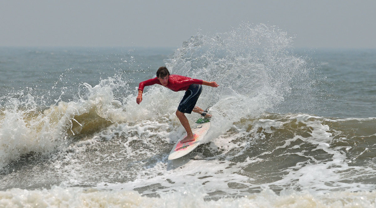
What about Folly?

Many of the surf forecasters are predicting some surf arriving this weekend with the best stuff on Sunday.  Awesome, crowds galore.  Depending on the strength of this storm, right now were only expected to experience a windswell event.  Personally I think it will be a little better than windswell.  Local winds will be light and I think well see a more medium period swell.  Just my intuition speaking.
Seriously though, we haven't had any waves for a while so I'm pretty pumped up for the potential for some waist plus waves. 

Depending how the forecast holds, I will try to get out as early as possible to take a few shots with the camera.  High tide on Sunday will be around 5AM.  Not good because I'll only be able to catch the beginning of the afternoon tide thanks to work. 

Let's hope for the best.

MikeC